Subdivision developmentsConcept

Lotscape · concept studies

Send us your section.

Tell us about the land and what you have in mind, and we’ll delve into it. Developers: set out the project and send the plans you have, as a formal request to be considered. Landowners and people building a home: the basics are enough.

The full experience, priced for your project

Your new home or subdivision in 3D, on its own password-protected website: the renders, a walk-through, a 360° tour and your finishes side by side. Subdivisions are priced case by case. We confirm your price before any work starts. How pricing works.

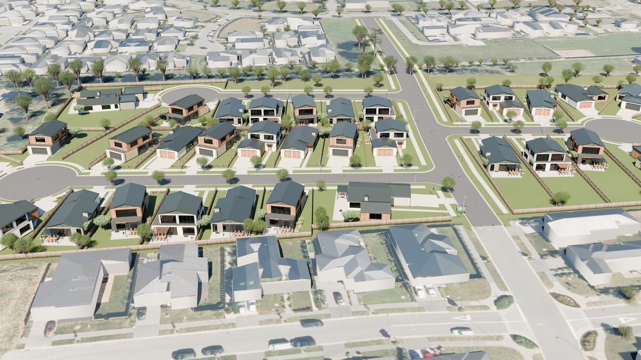
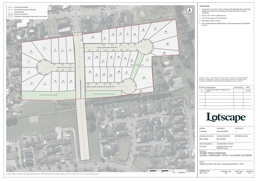
A render of a new subdivision street, homes and reserves from the airA concept plan sheet of the same subdivision: lots, areas and roads in a title block
Irvines Track paddocks, a hypothetical Christchurch exemplar: render and plan sheet. Concept only.

Considered on what you send

We look at every request on its details and its plans, and take on the sites we can do justice to. The more you send, the better we can judge it, and the better the concept.

Concept only, no strings attached

What we make is yours, for your own due diligence. It isn’t engineering design, a survey or a consent application, and it carries no professional indemnity: your engineer’s or surveyor’s sign-off is still needed before anyone relies on it. What concept means.

What happens next

We reply to every request by email. If we can take yours on, we’ll set out what we’d make for your site, and what it would cost for the scope you want, before any work starts.

Start by saying who you are. For a development, the form asks for the project’s details and its plans. For anything else, the basics are enough: your name, an email, the site and a few words about it.

What we need before we can consider a development: the project’s name, the site’s address, where it’s up to, how you hold the land, a description, and the plans you have or a link to them. Everything marked optional helps us judge it.

Who you are
The site

Search for the address. Then, if you can, mark the land on the map: trace the outline of the development area.drop a pin on it, or draw around it. The map is optional, and helps us find it.

Loading the map…

Click or tap the map to put a pin on your site. Drag the pin to move it.

Nothing marked on the map yet.

Imagery © Esri, Maxar, Earthstar Geographics and the GIS user community. Address search by Esri. The map is for finding the site, not a survey or a legal boundary.

The development
What you’d like

The price depends on the scope you want. Pick the closest: it can change once we’ve talked.

Anything in particular optional
The briefYour section
Plans and documentsYour files optional

Send the plans you have, or a link to them. A scheme plan, the record of title, a survey, a geotechnical report, servicing information or council advice: whatever exists. A development is considered on what comes with it.

A title or survey plan, a sketch on a photo, a scheme plan, a house design you already have. Anything helps; nothing is required.

What you’re sending tick what applies
Drop your files hereor choose files. As many as you like, or a whole folder: up to 200 MB in total, 95 MB a file and 60 files.

PDF, Word, Excel, images, video, shapefiles, zip, KML, GeoJSON, DXF, DWG, LandXML, LAS/LAZ, IFC, OBJ and GLB. For a shapefile, include its .shx, .dbf and .prj.